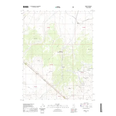
2021 Map of Aurora
USGS Topo · Published 2021About this map
Toiyabe National Forest dominates this high-altitude landscape where the Nevada-California state line cuts through the Bodie Hills. The terrain is defined by volcanic features and prominent summits, including Aurora Crater and Sugarloaf Mtn. Settlement is concentrated at Fletcher in the north and the mountain locality of Del Monte further south. The map reveals an intricate network of trails and rugged tracks like the Cemetery Spur Trl and Ruins Trl near Aurora Hill, which hint at the region's mining heritage. Water is scarce in this arid environment, marked by intermittent flows like Rough Cr and Bodie Cr, along with isolated points like Fletcher Spring and Tamarack Spring. The presence of Dry Lake in the southwest further illustrates the basin-and-range geography characteristic of this borderland area.
Find a feature on this map
52 named features on this map. Tap any name to fly to it.
Don’t see what you’re looking for? This feature index may not catch every label — zoom into the map to look around manually.
Map Details
Editions of this 2021 Aurora Map
This is the sole edition of this map. No revisions or reprints were ever made.
Other maps of this area

1909 · Hawthorne
USGS Topo · 1:250,000

1909 · Bridgeport
USGS Topo · 1:125,000

1911 · Bridgeport
USGS Topo · 1:125,000

1911 · Hawthorne
USGS Topo · 1:250,000

1915 · Hawthorne
USGS Topo · 1:250,000

1920 · Bridgeport
USGS Topo · 1:125,000

1948 · Walker Lake
USGS Topo · 1:250,000

1956 · Aurora
USGS Topo · 1:62,500

1957 · Walker Lake
USGS Topo · 1:250,000

1958 · Bodie
USGS Topo · 1:62,500