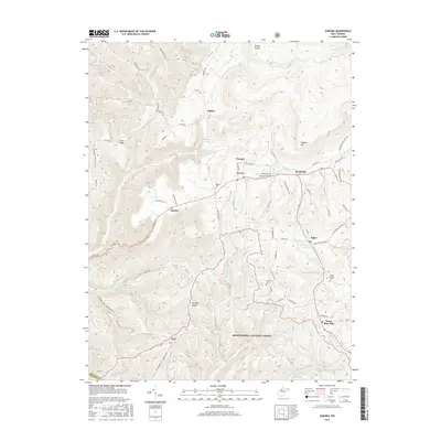
2016 Map of Aurora
USGS Topo · Published 2016About this map
Stemple Ridge and Shaffer Mtn dominate this high-elevation landscape in Preston County, where the southern reaches of the Monongahela National Forest meet several small mountain communities. The settlement of Aurora serves as a central hub along US Rte 50, surrounded by smaller hamlets like Amboy, Brookside, and Eglon. Genealogists will find a cluster of burial sites including Beachy Cem, Accident Cem, and Maple Spring Cem that anchor these long-standing rural neighborhoods. The terrain is defined by a dense network of headwaters, including Horseshoe Run and Wolf Cr, alongside notable natural features like Old Indian Spring and Lace White Spring. This survey captures the area's transition from forest to upland farming, with numerous family-named landmarks and local connectors like Co Rte 114 and Scott Sisler Rd stitching the communities together.
Find a feature on this map
86 named features on this map. Tap any name to fly to it.
Don’t see what you’re looking for? This feature index may not catch every label — zoom into the map to look around manually.
Map Details
Editions of this 2016 Aurora Map
This is the sole edition of this map. No revisions or reprints were ever made.
Other maps of this area

1886 · St. George
USGS Topo · 1:125,000

1891 · St. George
USGS Topo · 1:125,000

1895 · Piedmont
USGS Topo · 1:125,000

1899 · Oakland
USGS Topo · 1:62,500

1900 · Oakland
USGS Topo · 1:62,500

1907 · Kingwood
USGS Topo · 1:62,500

1908 · Parsons
USGS Topo · 1:62,500

1916 · Davis
USGS Topo · 1:48,000

1918 · Davis
USGS Topo · 1:62,500

1919 · Davis
USGS Topo · 1:62,500