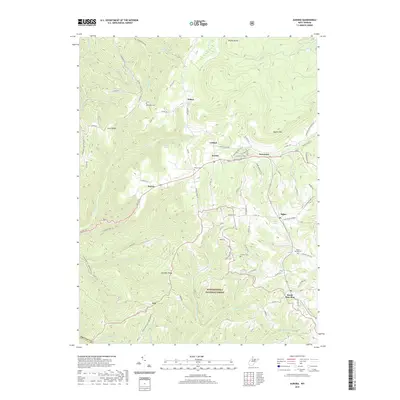
2019 Map of Aurora
USGS Topo · Published 2019About this map
Aurora and its neighboring rural settlements sit at a high elevation in Preston County, where the terrain is defined by prominent elevations like Shaffer Mountain and Stemple Ridge. This landscape, much of it protected within the Monongahela National Forest, shows a distribution of small communities and family landmarks such as Brookside, Eglon, and Amboy. The map documents a network of mountain roads including the Aurora Pike and Accident Road, which connect isolated farms and local institutions. Genealogists will find significant value in the distribution of burial grounds across these ridges, including Accident Cemetery, Beachy Cemetery, and Maple Spring Cemetery. Water sources like Horseshoe Run and Old Indian Spring emphasize the importance of natural drainage in shaping the settlement patterns of this upland region.
Find a feature on this map
84 named features on this map. Tap any name to fly to it.
Don’t see what you’re looking for? This feature index may not catch every label — zoom into the map to look around manually.
Map Details
Editions of this 2019 Aurora Map
This is the sole edition of this map. No revisions or reprints were ever made.
Other maps of this area

1886 · St. George
USGS Topo · 1:125,000

1891 · St. George
USGS Topo · 1:125,000

1895 · Piedmont
USGS Topo · 1:125,000

1899 · Oakland
USGS Topo · 1:62,500

1900 · Oakland
USGS Topo · 1:62,500

1907 · Kingwood
USGS Topo · 1:62,500

1908 · Parsons
USGS Topo · 1:62,500

1916 · Davis
USGS Topo · 1:48,000

1918 · Davis
USGS Topo · 1:62,500

1919 · Davis
USGS Topo · 1:62,500