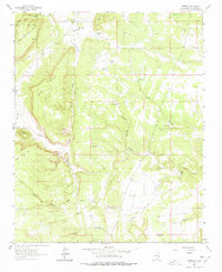
1963 Map of Aurora
USGS Topo · Published 1978About this map
Gonzales Ranch anchors the northern portion of this landscape, serving as a focal point for local life with the Santa Teresita Ch and the Gonzales Ranch Sch providing essential community infrastructure. The terrain is characterized by a network of deeply etched canyons and high mesas, including the prominent Mesa Sola and Mesa Sacatosa. Water management in this high-desert environment is evident through named features like Laguna Seca, Gordo Tank, and various livestock tanks such as North Tank and West Tank.
Find a feature on this map
39 named features on this map. Tap any name to fly to it.
Don’t see what you’re looking for? This feature index may not catch every label — zoom into the map to look around manually.
Map Details
Editions of this 1963 Aurora Map
2 editions found
Other maps of this area

1890 · Bernal
USGS Topo · 1:125,000

1891 · Bernal
USGS Topo · 1:125,000

1894 · Bernal
USGS Topo · 1:125,000

1894 · Lamy
USGS Topo · 1:125,000

1954 · Santa Fe
USGS Topo · 1:250,000

1958 · Santa Fe
USGS Topo · 1:250,000

1960 · Villanueva
USGS Topo · 1:62,500

1963 · Jacinto Mesa
USGS Topo · 1:24,000

1963 · Aurora
USGS Topo · 1:24,000
1963 · Potrillo Hill
USGS Topo · 1:24,000