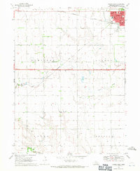
1968 Map of Aurora West
USGS Topo · Published 1971About this map
Aurora serves as the primary hub of this Hamilton County landscape, appearing here as it was surveyed in the late 1960s. The town's grid is dense with civic and social infrastructure, from the County Fairground and Streeter Park to the Home for the Aged and local medical facilities. Beyond the city limits, the terrain transitions into a strictly organized agricultural grid, defined by numerous irrigation wells and intersected by the diagonal line of the Chicago Burlington and Quincy railroad. Rural life is anchored by landmarks such as Pleasant View Ch, Prairie Gem Cem, and the Miller Sch. To the south, the geometric precision of the township sections gives way to the natural meanders of Beaver Creek and the W Fk Big Blue River, where the elevation contours tighten as they approach the river valley near Seaton Cem.
Find a feature on this map
28 named features on this map. Tap any name to fly to it.
Don’t see what you’re looking for? This feature index may not catch every label — zoom into the map to look around manually.
Map Details
Editions of this 1968 Aurora West Map
2 editions found

Other maps of this area

1898 · York
USGS Topo · 1:125,000

1898 · Grand Island
USGS Topo · 1:125,000

1899 · York
USGS Topo · 1:125,000

1955 · Lincoln
USGS Topo · 1:250,000

1955 · Grand Island
USGS Topo · 1:250,000

1957 · Lincoln
USGS Topo · 1:250,000

1957 · Grand Island
USGS Topo · 1:250,000

1958 · Grand Island
USGS Topo · 1:250,000

1958 · Lincoln
USGS Topo · 1:250,000
1962 · Phillips
USGS Topo · 1:24,000