
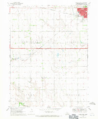
1968 Map of Aurora West
USGS Topo · Published 1982About this map
The agricultural landscape of Hamilton County centers on the western edge of Aurora, where civic and social life is anchored by institutions like the Home for the Aged, City Hall, and the County Fairground. Educational facilities serving the community include the Miller Sch, Jr High Sch, and Beam Sch, reflecting a structured network of rural and small-town schooling during the late 1960s.
Find a feature on this map
30 named features on this map. Tap any name to fly to it.
Don’t see what you’re looking for? This feature index may not catch every label — zoom into the map to look around manually.
Map Details
Editions of this 1968 Aurora West Map
2 editions found
Other maps of this area

1898 · York
USGS Topo · 1:125,000

1898 · Grand Island
USGS Topo · 1:125,000

1899 · York
USGS Topo · 1:125,000

1955 · Lincoln
USGS Topo · 1:250,000

1955 · Grand Island
USGS Topo · 1:250,000

1957 · Lincoln
USGS Topo · 1:250,000

1957 · Grand Island
USGS Topo · 1:250,000

1958 · Grand Island
USGS Topo · 1:250,000

1958 · Lincoln
USGS Topo · 1:250,000
1962 · Phillips
USGS Topo · 1:24,000