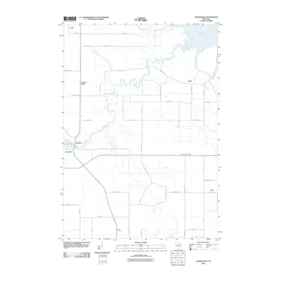
2010 Map of Auroraville
USGS Topo · Published 2010About this map
Willow Creek meanders through the central landscape of this Waushara County region, feeding into the Auroraville Millpond 80 and passing the Auroraville 2WP588 Dam. The settlement of Auroraville serves as a primary focal point, while smaller communities like Borth and Fountain Valley are connected by a network of county highways. This survey illustrates a rural Wisconsin landscape where agriculture and water management are intertwined, evidenced by the drainage into the northwest corner of Lake Poygan via Pumpkinseed Creek and the Pine River. Local history is anchored by several sites of genealogical importance, including Poy Sippi Cemetery in the north and the Welsh Cemetery to the south. The presence of Zink Airport on the eastern edge reflects the area's modern infrastructure within a traditionally agrarian setting.
Find a feature on this map
31 named features on this map. Tap any name to fly to it.
Don’t see what you’re looking for? This feature index may not catch every label — zoom into the map to look around manually.
Map Details
Editions of this 2010 Auroraville Map
This is the sole edition of this map. No revisions or reprints were ever made.
Other maps of this area

1915 · Neshkoro
USGS Topo · 1:48,000

1916 · Ripon
USGS Topo · 1:48,000

1918 · Neshkoro
USGS Topo · 1:62,500

1918 · Ripon
USGS Topo · 1:62,500

1955 · Green Bay
USGS Topo · 1:250,000

1956 · Ripon
USGS Topo · 1:62,500

1957 · Madison
USGS Topo · 1:250,000

1960 · Madison
USGS Topo · 1:250,000

1961 · Poy Sippi
USGS Topo · 1:62,500

1961 · Redgranite
USGS Topo · 1:62,500