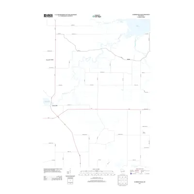
2013 Map of Auroraville
USGS Topo · Published 2013About this map
Willow Creek meanders through the central landscape of this Waushara County quadrangle, linking the small rural settlements of Auroraville and Borth. The eastern portion of the map is dominated by the marshy inlets of Lake Poygan, where Pumpkinseed Creek and the Pine River reach the lake. The region's agricultural and rural character is defined by a dense grid of county roads and avenues, with State Road 21 serving as a major east-west corridor. Local history is preserved in the naming of thoroughfares like Liberty School Rd and Stone School Rd, which mark the sites of former community landmarks. Small-scale aviation and water management are represented by Zink Airport and the Auroraville Millpond 80, reflecting how the local population has historically utilized both the land and its waterways for transport and industry.
Find a feature on this map
43 named features on this map. Tap any name to fly to it.
Don’t see what you’re looking for? This feature index may not catch every label — zoom into the map to look around manually.
Map Details
Editions of this 2013 Auroraville Map
This is the sole edition of this map. No revisions or reprints were ever made.
Other maps of this area

1915 · Neshkoro
USGS Topo · 1:48,000

1916 · Ripon
USGS Topo · 1:48,000

1918 · Neshkoro
USGS Topo · 1:62,500

1918 · Ripon
USGS Topo · 1:62,500

1955 · Green Bay
USGS Topo · 1:250,000

1956 · Ripon
USGS Topo · 1:62,500

1957 · Madison
USGS Topo · 1:250,000

1960 · Madison
USGS Topo · 1:250,000

1961 · Poy Sippi
USGS Topo · 1:62,500

1961 · Redgranite
USGS Topo · 1:62,500