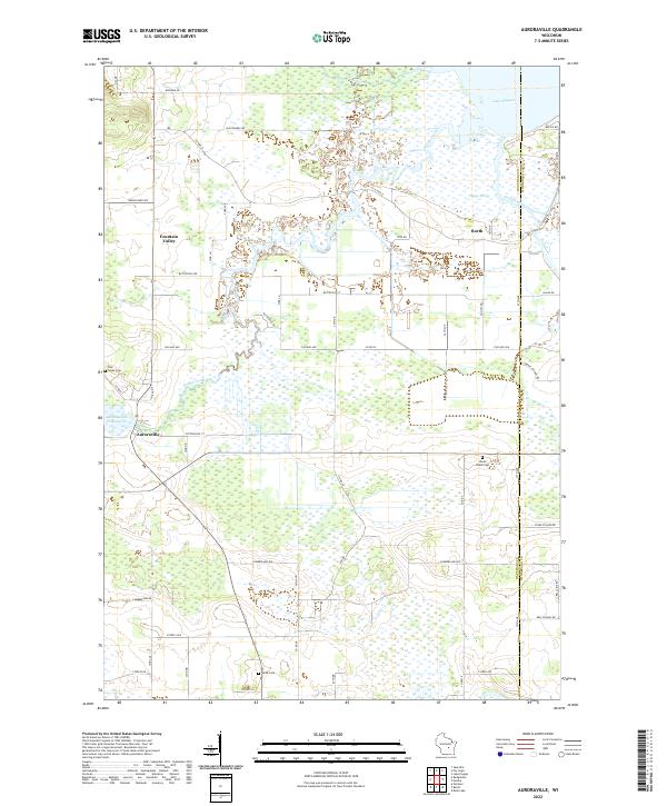
2022 Map of Auroraville
USGS Topo · Published 2022About this map
Auroraville and the surrounding marshlands of eastern Waushara County are defined by a complex network of waterways feeding into the western reaches of Lake Poygan. The landscape is a mosaic of agricultural plots and low-lying wetlands, notably the Poygan Marsh, where Willow Creek and Pumpkinseed Creek converge. Small clusters of settlement at Borth and Fountain Valley anchor the rural grid, which is punctuated by several longstanding burial grounds including Welsh Cem, Pine Grove Cem, and the secluded Shead Island Cem. The local industry's historical reliance on water power is evident at the Auroraville Millpond, while the boundary between Waushara Co and Winnebago Co runs north-south through the marshes, marking a transition into the larger lake basin.
Find a feature on this map
54 named features on this map. Tap any name to fly to it.
Don’t see what you’re looking for? This feature index may not catch every label — zoom into the map to look around manually.
Map Details
Editions of this 2022 Auroraville Map
This is the sole edition of this map. No revisions or reprints were ever made.
Other maps of this area

1915 · Neshkoro
USGS Topo · 1:48,000

1916 · Ripon
USGS Topo · 1:48,000

1918 · Neshkoro
USGS Topo · 1:62,500

1918 · Ripon
USGS Topo · 1:62,500

1955 · Green Bay
USGS Topo · 1:250,000

1956 · Ripon
USGS Topo · 1:62,500

1957 · Madison
USGS Topo · 1:250,000

1960 · Madison
USGS Topo · 1:250,000

1961 · Poy Sippi
USGS Topo · 1:62,500

1961 · Redgranite
USGS Topo · 1:62,500