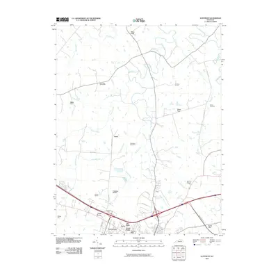
2010 Map of Austerlitz
USGS Topo · Published 2010About this map
Strodes Creek and Pretty Run wind through this central Kentucky landscape, defining a region where agricultural traditions meet modern development. The map details several distinct residential clusters and historic localities, including the namesake Austerlitz and the higher elevation of Stony Point. Further south, the suburban expansion near Winchester is evident through the naming of neighborhoods like Victory Heights, Meadowbrook, and Forrest Park. This interplay between the rural stock farm tradition, exemplified by Holmhurst Stock Farm, and twentieth-century infrastructure like the Codell Airport illustrates the area's transition. Genealogists will find the Gist Family Cemetery and the more contemporary Clarmont Memorial Gardens well-marked, while terrain enthusiasts can locate the distinctive Devils Backbone ridge. The road network connects older settlements like Renick and Constant Station to the modern commercial corridors along Enterprise Dr.
Find a feature on this map
38 named features on this map. Tap any name to fly to it.
Don’t see what you’re looking for? This feature index may not catch every label — zoom into the map to look around manually.
Map Details
Editions of this 2010 Austerlitz Map
This is the sole edition of this map. No revisions or reprints were ever made.
Other maps of this area

1892 · Richmond
USGS Topo · 1:125,000

1897 · Richmond
USGS Topo · 1:125,000

1927 · Lexington
USGS Topo · 1:48,000

1929 · Lexington
USGS Topo · 1:62,500

1952 · Paris East
USGS Topo · 1:24,000

1952 · Clintonville
USGS Topo · 1:24,000

1952 · Austerlitz
USGS Topo · 1:24,000

1952 · North Middletown
USGS Topo · 1:24,000

1952 · Ford
USGS Topo · 1:24,000

1952 · Winchester
USGS Topo · 1:24,000