
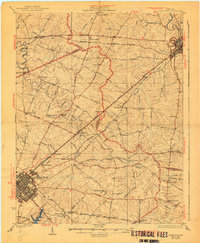
1929 Map of Lexington
USGS Topo · Published 1929About this map
Lexington and Paris anchor this 1920s survey of the Bluegrass region, where a dense network of turnpikes and pikes connects thoroughbred estates and small agrarian hamlets. The landscape is defined by the winding course of the North Elkhorn Creek and the South Fork Elkhorn Creek, dotted with historic landmarks like Russell Cave and the expansive grounds of Elmendorf. A complex web of transportation, including the Louisville and Nashville RR and the Southern Ry, crisscrosses the rolling terrain, serving established communities such as Newtown, Clintonville, and Chilesburg.
Find a feature on this map
80 named features on this map. Tap any name to fly to it.
Don’t see what you’re looking for? This feature index may not catch every label — zoom into the map to look around manually.
Map Details
Editions of this 1929 Lexington Map
2 editions found
Other maps of this area

1892 · Richmond
USGS Topo · 1:125,000

1897 · Richmond
USGS Topo · 1:125,000

1905 · Harrodsburg
USGS Topo · 1:125,000

1906 · Georgetown
USGS Topo · 1:62,500

1908 · Georgetown
USGS Topo · 1:62,500

1927 · Lexington
USGS Topo · 1:48,000

1929 · Cynthiana
USGS Topo · 1:48,000

1934 · Cynthiana
USGS Topo · 1:62,500

1939 · Sadieville
USGS Topo · 1:62,500

1950 · Lexington East
USGS Topo · 1:24,000