
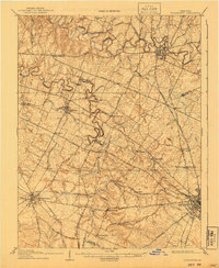
1908 Map of Georgetown
USGS Topo · Published 1908About this map
The Bluegrass region of Kentucky is defined here by its intricate network of river bends and turnpikes connecting the major hubs of Georgetown, Versailles, and the northwestern edge of Lexington. Meandering through the heart of the landscape, the North Elkhorn Creek and South Elkhorn Creek create a deeply sinuous drainage pattern that influenced the placement of early settlements and rail lines. Five different railroads, including the Southern Ry and the Louisville and Nashville RR, intersect the territory, serving established communities like Midway and Paynes Depot. The map captures a sophisticated 1908 infrastructure of pikes, such as the Ironworks Pike and Leestown Pike, which reflect the region's early transition from pioneer trails to a structured commercial corridor for the tobacco and equine economies. Notable smaller localities like White Sulphur and Pisgah appear as they were before modern development shifted the rural character of Scott and Woodford counties.
Find a feature on this map
57 named features on this map. Tap any name to fly to it.
Don’t see what you’re looking for? This feature index may not catch every label — zoom into the map to look around manually.
Map Details
Editions of this 1908 Georgetown Map
2 editions found
Other maps of this area

1892 · Richmond
USGS Topo · 1:125,000

1897 · Richmond
USGS Topo · 1:125,000

1905 · Harrodsburg
USGS Topo · 1:125,000

1906 · Lockport
USGS Topo · 1:48,000

1906 · Georgetown
USGS Topo · 1:62,500

1908 · Lockport
USGS Topo · 1:62,500

1922 · Frankfort
USGS Topo · 1:48,000

1924 · Frankfort
USGS Topo · 1:62,500

1927 · Lexington
USGS Topo · 1:48,000

1929 · Cynthiana
USGS Topo · 1:48,000