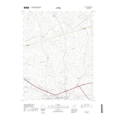
2019 Map of Austerlitz
USGS Topo · Published 2019About this map
Winchester anchor the southern portion of this region, where the expanding suburbs of Forrest Park and Bel Air meet the Bluegrass farmland. The landscape is defined by the winding paths of Stoner Creek and Strodes Creek, which carve through the territory between Clark Co and Bourbon Co. To the north, the small settlements of Austerlitz and Stony Point maintain their rural character, connected by historic thoroughfares like Van Meter Rd and Escondida Rd. Genealogy researchers will find the Gist Family Cem tucked away near Pretty Run, while local historians can trace the development of the Renick area and its Renick Field. The map illustrates a modern Kentucky landscape where legacy family landmarks and cemeteries coexist with newer residential developments like Meadowbrook and Bon Haven.
Find a feature on this map
57 named features on this map. Tap any name to fly to it.
Don’t see what you’re looking for? This feature index may not catch every label — zoom into the map to look around manually.
Map Details
Editions of this 2019 Austerlitz Map
This is the sole edition of this map. No revisions or reprints were ever made.
Other maps of this area

1892 · Richmond
USGS Topo · 1:125,000

1897 · Richmond
USGS Topo · 1:125,000

1927 · Lexington
USGS Topo · 1:48,000

1929 · Lexington
USGS Topo · 1:62,500

1952 · Paris East
USGS Topo · 1:24,000

1952 · Clintonville
USGS Topo · 1:24,000

1952 · Austerlitz
USGS Topo · 1:24,000

1952 · North Middletown
USGS Topo · 1:24,000

1952 · Ford
USGS Topo · 1:24,000

1952 · Winchester
USGS Topo · 1:24,000