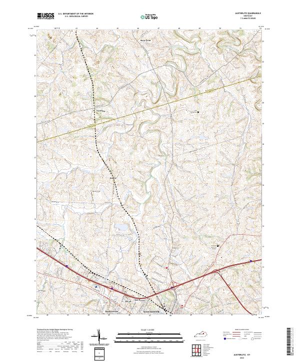
2022 Map of Austerlitz
USGS Topo · Published 2022About this map
Winchester anchors the southern portion of this landscape, where the urban street grid of the northern city limits meets the rolling bluegrass country of Clark and Bourbon Counties. This modern survey illustrates the suburban expansion of neighborhoods like Bel Air, Bon Haven, and Meadowbrook near the intersection of Mount Sterling Rd and the Veterans Memorial Pkwy. North of the city, the landscape transitions into a network of large rural estates and agricultural tracts defined by the winding paths of Strodes Creek and Pretty Run. The settlement of Austerlitz sits near the county line, while the Gist Family Cem and Clarmont Memorial Gardens offer localized points of interest for genealogists tracing family roots in the area. The terrain is marked by numerous small tributaries including Hancock Cr and Johnson Cr, which have historically shaped the drainage and development patterns of these central Kentucky uplands.
Find a feature on this map
71 named features on this map. Tap any name to fly to it.
Don’t see what you’re looking for? This feature index may not catch every label — zoom into the map to look around manually.
Map Details
Editions of this 2022 Austerlitz Map
This is the sole edition of this map. No revisions or reprints were ever made.
Other maps of this area

1892 · Richmond
USGS Topo · 1:125,000

1897 · Richmond
USGS Topo · 1:125,000

1927 · Lexington
USGS Topo · 1:48,000

1929 · Lexington
USGS Topo · 1:62,500

1952 · Paris East
USGS Topo · 1:24,000

1952 · Clintonville
USGS Topo · 1:24,000

1952 · Austerlitz
USGS Topo · 1:24,000

1952 · North Middletown
USGS Topo · 1:24,000

1952 · Ford
USGS Topo · 1:24,000

1952 · Winchester
USGS Topo · 1:24,000