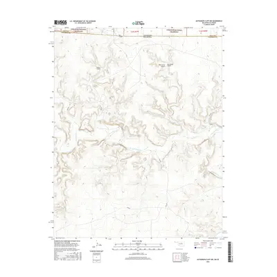
2016 Map of Autograph Cliff NW
USGS Topo · Published 2016About this map
The Cimarron River carves a deep, winding path through this corner of the High Plains, where the state lines of Colorado and Oklahoma meet. This terrain is characterized by a complex network of drainages and named breaks, including Arthurs Canyon, West Squaw Canyon, and East Squaw Canyon. To the north, the land transitions into the protected expanse of the Comanche National Grassland, highlighting a landscape where public grazing land and natural riparian corridors dominate. Beyond the river, the map detail captures smaller water features like Cold Springs Cr and the prominent Red Canyon in the northwest. The presence of rural routes such as E0095 Rd and N0155 Rd illustrates the grid-based infrastructure that supports the isolated ranching communities of Cimarron County.
Find a feature on this map
14 named features on this map. Tap any name to fly to it.
Don’t see what you’re looking for? This feature index may not catch every label — zoom into the map to look around manually.
Map Details
Editions of this 2016 Autograph Cliff NW Map
This is the sole edition of this map. No revisions or reprints were ever made.
Other maps of this area

1891 · Springfield
USGS Topo · 1:125,000

1893 · Springfield
USGS Topo · 1:125,000

1954 · Dalhart
USGS Topo · 1:250,000

1955 · La Junta
USGS Topo · 1:250,000

1958 · La Junta
USGS Topo · 1:250,000

1958 · Dalhart
USGS Topo · 1:250,000

1962 · Dalhart
USGS Topo · 1:250,000

1968 · La Junta
USGS Topo · 1:250,000

1968 · Autograph Cliff NW
USGS Topo · 1:24,000

1969 · Flagg Springs
USGS Topo · 1:24,000