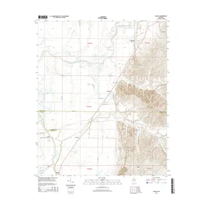
2015 Map of Avalon
USGS Topo · Published 2015About this map
The Yalobusha River winds through this landscape at the intersection of Carroll, Leflore, and Grenada Counties, defining a region rich in delta bayous and upland creeks. The settlement of Avalon sits near the river's edge, surrounded by a complex network of water bodies including Fletcher Lake and Robinson Bayou Rd. To the north, the community of Parsons and the Minter Lake area illustrate the transition from the river lowlands to the more elevated terrain of the eastern portion of the quadrangle. Local history is anchored by numerous cemeteries that mark the heritage of the area, such as Shiloh Cem, Duncan Cem, and Saint James Cem. The map provides a detailed view of the rural infrastructure, from the Potacocowa Creek drainage to the smaller hamlets of Leflore, Whaley, and Valley.
Find a feature on this map
56 named features on this map. Tap any name to fly to it.
Don’t see what you’re looking for? This feature index may not catch every label — zoom into the map to look around manually.
Map Details
Editions of this 2015 Avalon Map
This is the sole edition of this map. No revisions or reprints were ever made.
Other maps of this area

1932 · Philipp
USGS Topo · 1:48,000

1935 · Philipp
USGS Topo · 1:62,500

1936 · Greenwood
USGS Topo · 1:62,500

1939 · Philipp
USGS Topo · 1:62,500

1940 · Greenwood
USGS Topo · 1:62,500

1953 · Greenwood
USGS Topo · 1:250,000

1953 · West Point
USGS Topo · 1:250,000

1954 · Grenada
USGS Topo · 1:62,500

1954 · McCarley
USGS Topo · 1:62,500

1956 · Greenwood
USGS Topo · 1:250,000