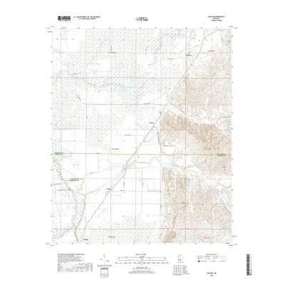
2018 Map of Avalon
USGS Topo · Published 2018About this map
Avalon sits at the intersection of bottomland hydrology and the rising hills of the Mississippi interior. This 2018 survey documents a landscape defined by the winding course of the Yalobusha River and the complex network of oxbows and sloughs that fragment the terrain, including Musselwhite Lake, Flat Lake, and Wolf Lake. The settlement pattern follows the higher ground east of the river valley, where the small communities of Parsons and Leflore are connected by a mesh of secondary roads like Old Hwy 7 and Twin Church Rd. Genealogists will find several notable burial sites recorded, including Shiloh Cem and Saint James Cem, while water bodies like Potacocowa Creek and the Avalon Cut-Off illustrate the ongoing engineering and natural drainage shifts in the region south of the Grenada and Carroll county line.
Find a feature on this map
61 named features on this map. Tap any name to fly to it.
Don’t see what you’re looking for? This feature index may not catch every label — zoom into the map to look around manually.
Map Details
Editions of this 2018 Avalon Map
This is the sole edition of this map. No revisions or reprints were ever made.
Other maps of this area

1932 · Philipp
USGS Topo · 1:48,000

1935 · Philipp
USGS Topo · 1:62,500

1936 · Greenwood
USGS Topo · 1:62,500

1939 · Philipp
USGS Topo · 1:62,500

1940 · Greenwood
USGS Topo · 1:62,500

1953 · Greenwood
USGS Topo · 1:250,000

1953 · West Point
USGS Topo · 1:250,000

1954 · Grenada
USGS Topo · 1:62,500

1954 · McCarley
USGS Topo · 1:62,500

1956 · Greenwood
USGS Topo · 1:250,000