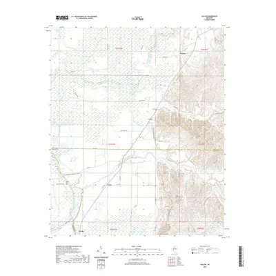
2020 Map of Avalon
USGS Topo · Published 2020About this map
Avalon and the surrounding alluvial lowlands sit at the intersection of Carroll, Leflore, and Grenada Counties, where the Yalobusha River meanders through a dense network of bayous and oxbow lakes. The landscape is defined by its complex hydrology, featuring numerous named water bodies like Oxberry Bayou, Blue Lake, and Musselwhite Lake that speak to the area's history of river migration and drainage. The settlement of Parsons sits to the north near the river's bend, while Leflore and Whaley mark the lower reaches of the map.
Find a feature on this map
74 named features on this map. Tap any name to fly to it.
Don’t see what you’re looking for? This feature index may not catch every label — zoom into the map to look around manually.
Map Details
Editions of this 2020 Avalon Map
This is the sole edition of this map. No revisions or reprints were ever made.
Other maps of this area

1932 · Philipp
USGS Topo · 1:48,000

1935 · Philipp
USGS Topo · 1:62,500

1936 · Greenwood
USGS Topo · 1:62,500

1939 · Philipp
USGS Topo · 1:62,500

1940 · Greenwood
USGS Topo · 1:62,500

1953 · Greenwood
USGS Topo · 1:250,000

1953 · West Point
USGS Topo · 1:250,000

1954 · Grenada
USGS Topo · 1:62,500

1954 · McCarley
USGS Topo · 1:62,500

1956 · Greenwood
USGS Topo · 1:250,000