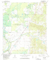
1982 Map of Avalon
USGS Topo · Published 1982About this map
The Yalobusha River and its meandering oxbows define the landscape of the Delta's edge in the early 1980s. This survey captures a dense network of small rural communities and church centers, such as Avalon, Whaley, and Parsons, situated along the winding waterways and the Avalon Cutoff. The map reveals the intricate hydrology of the region, where Potacocowa Creek meets the river plain, surrounded by numerous named lakes like Wolf Lake and Flat Lake. For genealogists and local historians, the sheet is exceptionally detailed in its placement of country churches and burial grounds, including Union Grove Ch, Shiloh Ch, and the St James Cem. Large portions of the floodplain are dedicated to the Malmaison State Wildlife Management Area, illustrating the preserved natural character of the bottomlands alongside active agricultural zones near Valley.
Find a feature on this map
52 named features on this map. Tap any name to fly to it.
Don’t see what you’re looking for? This feature index may not catch every label — zoom into the map to look around manually.
Map Details
Editions of this 1982 Avalon Map
This is the sole edition of this map. No revisions or reprints were ever made.
Other maps of this area

1932 · Philipp
USGS Topo · 1:48,000

1935 · Philipp
USGS Topo · 1:62,500

1936 · Greenwood
USGS Topo · 1:62,500

1939 · Philipp
USGS Topo · 1:62,500

1940 · Greenwood
USGS Topo · 1:62,500

1953 · Greenwood
USGS Topo · 1:250,000

1953 · West Point
USGS Topo · 1:250,000

1954 · Grenada
USGS Topo · 1:62,500

1954 · McCarley
USGS Topo · 1:62,500

1956 · Greenwood
USGS Topo · 1:250,000