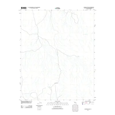
2012 Map of Avawatz Pass
USGS Topo · Published 2012About this map
Avawatz Pass sits as a critical geographic crossing in the arid landscape of San Bernardino County, where water sources determine the patterns of movement and survival. This survey highlights the sparse but vital network of springs that sustained travel through the high desert, including Cave Spring and Denning Spring. The terrain is defined by complex drainage patterns that converge at these water points, suggesting the historical routes used by miners and early travelers navigating this portion of the Mojave. The presence of Arrastre Spring points to the region's mining heritage, as an arrastre was a primitive mill used for grinding ore, indicating labor and industry once centered around this specific water source near Cottonwood Spring.
Find a feature on this map
5 named features on this map. Tap any name to fly to it.
Don’t see what you’re looking for? This feature index may not catch every label — zoom into the map to look around manually.
Map Details
Editions of this 2012 Avawatz Pass Map
This is the sole edition of this map. No revisions or reprints were ever made.
Other maps of this area

1933 · Avawatz Mountains
USGS Topo · 1:250,000

1947 · Trona
USGS Topo · 1:250,000

1948 · Red Pass Lake
USGS Topo · 1:62,500

1948 · Trona
USGS Topo · 1:250,000

1948 · Leach Lake
USGS Topo · 1:62,500

1948 · Avawatz Pass
USGS Topo · 1:62,500

1948 · Tiefort Mountains
USGS Topo · 1:62,500

1951 · Tiefort Mountains
USGS Topo · 1:62,500

1951 · Avawatz Pass
USGS Topo · 1:62,500

1951 · Red Pass Lake
USGS Topo · 1:62,500