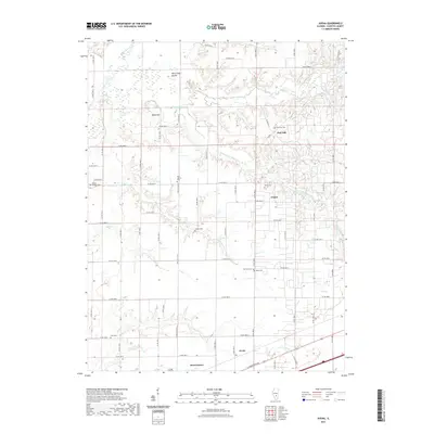
2021 Map of Avena
USGS Topo · Published 2021About this map
Brownstown and the settlement of Avena anchor the southern portion of this Fayette County landscape, where the E Cumberland Rd corridor transitions into a grid of rural section roads. The terrain is defined by the winding course of the S Fork Kaskaskia River and its numerous tributaries, including Linn Cr and Camp Cr, which carve through the central prairies. Prominent landmarks like White Oak Mound and Island Hill rise above the river bottoms, providing distinct points of orientation in a region historically shaped by small-scale agriculture and dispersed rural communities. For the local historian or genealogist, the map is remarkably dense with burial sites, preserving the locations of New Liberty Cem, Mount Carmel Cem, and Post Oak Cem, among several others that trace the early settlement patterns of the township.
Find a feature on this map
44 named features on this map. Tap any name to fly to it.
Don’t see what you’re looking for? This feature index may not catch every label — zoom into the map to look around manually.
Map Details
Editions of this 2021 Avena Map
This is the sole edition of this map. No revisions or reprints were ever made.
Other maps of this area

1941 · St. Elmo
USGS Topo · 1:62,500

1944 · Ramsey
USGS Topo · 1:62,500

1945 · St. Elmo
USGS Topo · 1:62,500

1945 · Kinmundy
USGS Topo · 1:62,500

1945 · Vandalia
USGS Topo · 1:62,500

1946 · Ramsey
USGS Topo · 1:62,500

1947 · Vandalia
USGS Topo · 1:62,500

1947 · Kinmundy
USGS Topo · 1:62,500

1958 · Decatur
USGS Topo · 1:250,000

1958 · Belleville
USGS Topo · 1:250,000