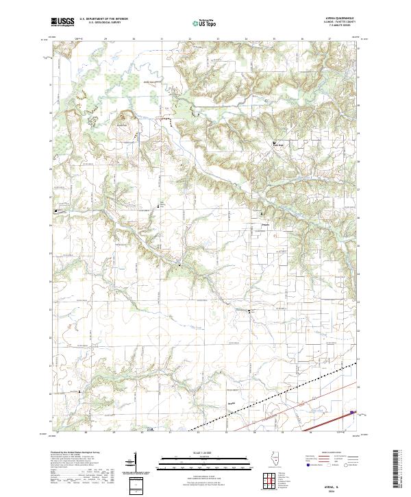
2024 Map of Avena
USGS Topo · Published 2024About this map
The Kaskaskia River and its numerous tributaries, including Big Creek and the South Fork Kaskaskia River, dominate this section of Fayette County. This rural landscape is defined by its deep network of creeks and small settlements like Avena and Post Oak. The topography reveals distinctive local landmarks such as White Oak Mound and Island Hill, rising above the winding waterways. For genealogists, the map is a significant record of local burial sites, documenting Mount Carmel Cem, Liberty Cem, and Yolton Cem, among several others. The road system, including E Cumberland Rd, follows a strict grid that navigates around the irregular terrain of Suck Creek and Linn Creek, illustrating the persistence of early twentieth-century land division patterns into the modern era.
Find a feature on this map
64 named features on this map. Tap any name to fly to it.
Don’t see what you’re looking for? This feature index may not catch every label — zoom into the map to look around manually.
Map Details
Editions of this 2024 Avena Map
This is the sole edition of this map. No revisions or reprints were ever made.
Other maps of this area

1941 · St. Elmo
USGS Topo · 1:62,500

1944 · Ramsey
USGS Topo · 1:62,500

1945 · St. Elmo
USGS Topo · 1:62,500

1945 · Kinmundy
USGS Topo · 1:62,500

1945 · Vandalia
USGS Topo · 1:62,500

1946 · Ramsey
USGS Topo · 1:62,500

1947 · Vandalia
USGS Topo · 1:62,500

1947 · Kinmundy
USGS Topo · 1:62,500

1958 · Decatur
USGS Topo · 1:250,000

1958 · Belleville
USGS Topo · 1:250,000