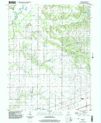
1998 Map of Avena
USGS Topo · Published 2003About this map
The Kaskaskia River winds through the northwestern corner of this territory, where the landscape is defined by the drainage basins of Big Creek and its southern and little forks. The topography transitions from the alluvial bottomlands near Island Hill to the rolling uplands of Loudon and Sefton townships. Scattered across these sections are the markers of a distributed rural community, including several country churches such as United Ch and Fairview Ch, and numerous family and community burial grounds like Post Oak Cem and Liberty Cem.
Find a feature on this map
33 named features on this map. Tap any name to fly to it.
Don’t see what you’re looking for? This feature index may not catch every label — zoom into the map to look around manually.
Map Details
Editions of this 1998 Avena Map
This is the sole edition of this map. No revisions or reprints were ever made.
Other maps of this area

1941 · St. Elmo
USGS Topo · 1:62,500

1944 · Ramsey
USGS Topo · 1:62,500

1945 · St. Elmo
USGS Topo · 1:62,500

1945 · Kinmundy
USGS Topo · 1:62,500

1945 · Vandalia
USGS Topo · 1:62,500

1946 · Ramsey
USGS Topo · 1:62,500

1947 · Vandalia
USGS Topo · 1:62,500

1947 · Kinmundy
USGS Topo · 1:62,500

1958 · Decatur
USGS Topo · 1:250,000

1958 · Belleville
USGS Topo · 1:250,000