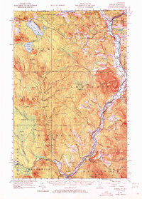
1953 Map of Averill
USGS Topo · Published 1972About this map
Canaan and Beecher Falls anchor the northern reaches of this borderland survey, where the international boundary meets the upper reaches of the Connecticut River. The landscape is dominated by a systematic network of logging camps, numbered from Camp No 3 to Camp No 20, which speak to the industrial timber operations managed across Lewis, Lemington, and Bloomfield during the mid-20th century. This resource extraction is supported by a infrastructure of splash dams and transport routes, including Peanut Dam, Brooks Dam, and the Maine Central railroad line.
Find a feature on this map
136 named features on this map. Tap any name to fly to it.
Don’t see what you’re looking for? This feature index may not catch every label — zoom into the map to look around manually.
Map Details
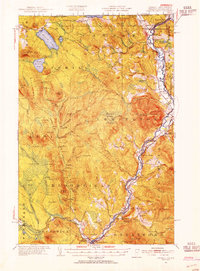
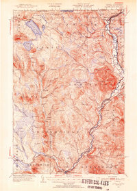
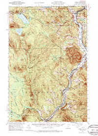
Editions of this 1953 Averill Map
5 editions found

Other maps of this area

1920 · Guildhall
USGS Topo · 1:62,500

1924 · Island Pond
USGS Topo · 1:48,000

1925 · Indian Stream
USGS Topo · 1:48,000

1926 · Island Pond
USGS Topo · 1:62,500

1926 · Indian Stream
USGS Topo · 1:62,500

1927 · Indian Stream
USGS Topo · 1:62,500

1929 · Averill
USGS Topo · 1:62,500

1930 · Percy
USGS Topo · 1:62,500

1930 · Dixville
USGS Topo · 1:62,500

1931 · Guildhall
USGS Topo · 1:48,000