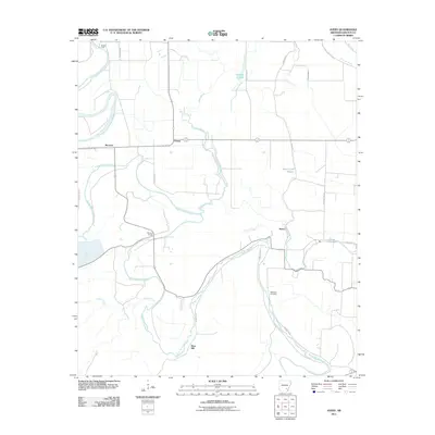
2011 Map of Avery
USGS Topo · Published 2011About this map
Bayou Bartholomew meanders heavily through this Lincoln County landscape, creating a complex network of oxbows and secondary waterways that define the local topography. This 2011 survey reveals a rural area centered on the small settlements of Avery, Fresno, and Meroney. The reliance on these waterways and their historical crossings is evident at Mattox Ford and Persons Bridge, which provide essential passage over the shifting bayou and its tributaries like Cane Creek and Village Creek.
Find a feature on this map
26 named features on this map. Tap any name to fly to it.
Don’t see what you’re looking for? This feature index may not catch every label — zoom into the map to look around manually.
Map Details
Editions of this 2011 Avery Map
This is the sole edition of this map. No revisions or reprints were ever made.
Other maps of this area

1935 · Feenyville
USGS Topo · 1:62,500

1935 · Varner
USGS Topo · 1:62,500

1935 · Noble Lake
USGS Topo · 1:62,500

1935 · Rotan
USGS Topo · 1:62,500

1948 · Helena
USGS Topo · 1:250,000

1950 · Helena
USGS Topo · 1:250,000

1953 · Greenwood
USGS Topo · 1:250,000

1955 · Helena
USGS Topo · 1:250,000

1956 · Greenwood
USGS Topo · 1:250,000

1959 · Helena
USGS Topo · 1:250,000