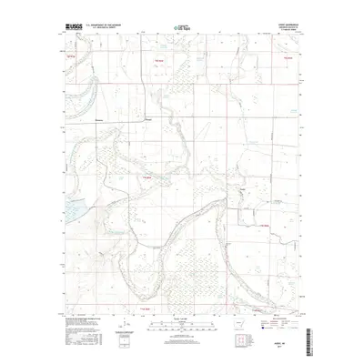
2017 Map of Avery
USGS Topo · Published 2017About this map
Bayou Bartholomew anchors this landscape in Lincoln County, winding through a complex network of wetlands and agricultural tracts. The terrain is defined by its extensive "brakes" and sloughs, such as Gibson Brake, Purtris Brake, and Dark Brake, which reveal the historical drainage patterns of the Arkansas Delta. Small rural settlements like Fresno, Meroney, and Avery are connected by a grid of county roads, including the historically descriptive Sorrels Ferry Rd. This 2017 survey details the intensive water management of the area, featuring several reservoirs like Pinchback Reservoir and Shooks Reservoir. For the local historian or genealogist, the map pinpoint's the location of the Mackwee Cem and traces the modern extent of Cane Cr Lake, providing a clear look at how the region's hydrography and small communities coexist in the early 21st century.
Find a feature on this map
56 named features on this map. Tap any name to fly to it.
Don’t see what you’re looking for? This feature index may not catch every label — zoom into the map to look around manually.
Map Details
Editions of this 2017 Avery Map
This is the sole edition of this map. No revisions or reprints were ever made.
Other maps of this area

1935 · Feenyville
USGS Topo · 1:62,500

1935 · Varner
USGS Topo · 1:62,500

1935 · Noble Lake
USGS Topo · 1:62,500

1935 · Rotan
USGS Topo · 1:62,500

1948 · Helena
USGS Topo · 1:250,000

1950 · Helena
USGS Topo · 1:250,000

1953 · Greenwood
USGS Topo · 1:250,000

1955 · Helena
USGS Topo · 1:250,000

1956 · Greenwood
USGS Topo · 1:250,000

1959 · Helena
USGS Topo · 1:250,000