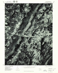
1977 Map of Avilton
USGS Topo · Published 1979About this map
Avilton sits within a high-elevation landscape of Garrett County during the late 1970s, where agricultural clearings and dense forest cover meet the crest of Negro Mountain. This orthophotograph, derived from 1977 aerial imagery, reveals the specific land-use patterns of the era, from the corridor near Piney Grove to the remote valley containing the Frostburg Reservoir. The visual data provides a literal look at the farmsteads and rural road networks connecting High Point and Salisbury, capturing the terrain exactly as it was managed before modern development. Notable watercourses including the Casselman River and the headwaters of the Savage River carve through the ridges, defining the drainage patterns that have historically shaped settlement in this corner of Maryland.
Find a feature on this map
9 named features on this map. Tap any name to fly to it.
Don’t see what you’re looking for? This feature index may not catch every label — zoom into the map to look around manually.
Map Details
Editions of this 1977 Avilton Map
This is the sole edition of this map. No revisions or reprints were ever made.
Other maps of this area

1898 · Frostburg
USGS Topo · 1:62,500

1899 · Grantsville
USGS Topo · 1:62,500

1901 · Frostburg
USGS Topo · 1:62,500

1904 · Grantsville
USGS Topo · 1:62,500

1908 · Frostburg
USGS Topo · 1:62,500

1921 · Meyersdale
USGS Topo · 1:62,500

1923 · Berlin
USGS Topo · 1:48,000

1929 · Berlin
USGS Topo · 1:62,500

1939 · Meyersdale
USGS Topo · 1:62,500

1944 · Berlin
USGS Topo · 1:62,500