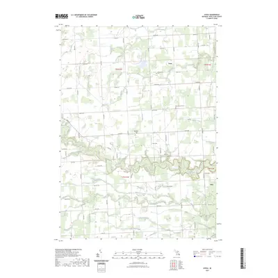
2023 Map of Avoca
USGS Topo · Published 2023About this map
Avoca sits at the heart of this St. Clair County landscape, serving as a central hub where Avoca Rd and Kilgore Rd intersect. The surrounding terrain is defined by an intricate network of agricultural drainage and natural waterways, most notably the winding course of Mill Creek and the southern flow of the Pine River. These waters have long influenced the placement of rural settlements and family homesteads throughout the townships.
Find a feature on this map
61 named features on this map. Tap any name to fly to it.
Don’t see what you’re looking for? This feature index may not catch every label — zoom into the map to look around manually.
Map Details
Editions of this 2023 Avoca Map
This is the sole edition of this map. No revisions or reprints were ever made.
Other maps of this area

1914 · Armada
USGS Topo · 1:62,500

1928 · Armada
USGS Topo · 1:62,500

1928 · Hicky
USGS Topo · 1:62,500

1939 · Smiths Creek
USGS Topo · 1:24,000

1939 · Goodells
USGS Topo · 1:24,000

1944 · Memphis
USGS Topo · 1:24,000

1952 · Memphis
USGS Topo · 1:24,000
1952 · Smiths Creek
USGS Topo · 1:24,000
1952 · Goodells
USGS Topo · 1:24,000

1954 · Detroit
USGS Topo · 1:250,000