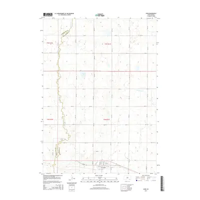
2015 Map of Avon
USGS Topo · Published 2015About this map
The town of Avon serves as the primary hub in this prairie landscape, where the local street grid including Main St and Avon Rd meets the surrounding agricultural section lines. This area is defined by its subtle drainage patterns, most notably the meandering course of Dry Choteau Cr which winds through the western portion of the quadrangle. The creek acts as a natural corridor along the Charles Mix Co Bon Homme Co line, illustrating how early political boundaries were often tied to these intermittent water features.
Find a feature on this map
32 named features on this map. Tap any name to fly to it.
Don’t see what you’re looking for? This feature index may not catch every label — zoom into the map to look around manually.
Map Details
Editions of this 2015 Avon Map
This is the sole edition of this map. No revisions or reprints were ever made.
Other maps of this area

1898 · Olivet
USGS Topo · 1:125,000

1955 · Sioux City
USGS Topo · 1:250,000

1955 · Sioux Falls
USGS Topo · 1:250,000

1955 · Mitchell
USGS Topo · 1:250,000

1955 · O'Neill
USGS Topo · 1:250,000

1958 · Sioux City
USGS Topo · 1:250,000

1958 · Sioux Falls
USGS Topo · 1:250,000

1959 · O'Neill
USGS Topo · 1:250,000

1959 · Sioux City
USGS Topo · 1:250,000

1959 · Mitchell
USGS Topo · 1:250,000