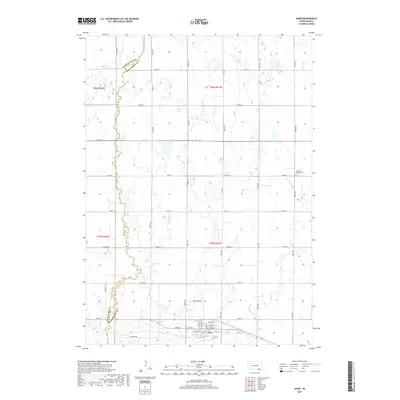
2017 Map of Avon
USGS Topo · Published 2017About this map
Avon serves as the primary hub in this southern South Dakota landscape, situated at the intersection of a grid-work of rural roads and state highways. The terrain is defined by the winding course of Dry Choteau Cr, which forms the political boundary between Charles Mix and Bon Homme counties. This watercourse, along with Little Emanuel Cr and the waters of Meiers Lake, suggests a prairie environment shaped by seasonal drainage and agricultural irrigation. Local history is anchored by the Gramkow - Vesper Cem located to the northeast of the town center, while names like Stone Hse Rd and Jefferson Rd hint at the early infrastructure of Bon Homme County. The map captures the meticulous township and range system that organized the Great Plains into productive sections.
Find a feature on this map
38 named features on this map. Tap any name to fly to it.
Don’t see what you’re looking for? This feature index may not catch every label — zoom into the map to look around manually.
Map Details
Editions of this 2017 Avon Map
This is the sole edition of this map. No revisions or reprints were ever made.
Other maps of this area

1898 · Olivet
USGS Topo · 1:125,000

1955 · Sioux City
USGS Topo · 1:250,000

1955 · Sioux Falls
USGS Topo · 1:250,000

1955 · Mitchell
USGS Topo · 1:250,000

1955 · O'Neill
USGS Topo · 1:250,000

1958 · Sioux City
USGS Topo · 1:250,000

1958 · Sioux Falls
USGS Topo · 1:250,000

1959 · O'Neill
USGS Topo · 1:250,000

1959 · Sioux City
USGS Topo · 1:250,000

1959 · Mitchell
USGS Topo · 1:250,000