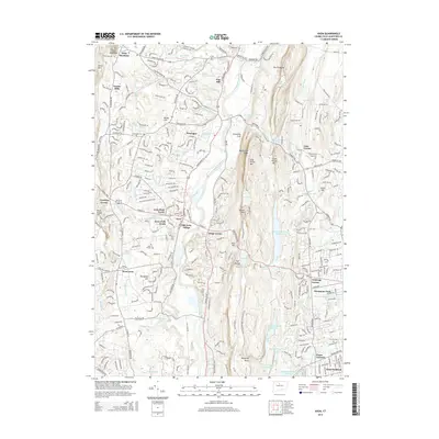
2015 Map of Avon
USGS Topo · Published 2015About this map
The Farmington River carves a central path through this modern survey of central Connecticut, separating the valley floor from the dramatic elevations of the Metacomet Ridge. To the west, the suburban character of Avon is well-established, with neighborhood clusters like Avon Park North and Old Avon Village showing the density of residential growth in the early 21st century. The map provides excellent detail for genealogists, recording several burial grounds including Bushy Hill Cem, Saint Ann Cem, and the Beth El Temple Cem. East of the river, the landscape rises sharply toward Talcott Mtn and King Phillip Mtn, where the New England National Scenic Trail traverses the ridgeline overlooking Hartford Reservoir Number 6. This juxtaposition of dense residential planning and conserved ridge lands highlights the region's commitment to preserving its prominent basalt traprock landmarks.
Find a feature on this map
261 named features on this map. Tap any name to fly to it.
Don’t see what you’re looking for? This feature index may not catch every label — zoom into the map to look around manually.
Map Details
Editions of this 2015 Avon Map
This is the sole edition of this map. No revisions or reprints were ever made.
Other maps of this area

1892 · Hartford
USGS Topo · 1:62,500

1892 · Meriden
USGS Topo · 1:62,500

1892 · Granby
USGS Topo · 1:62,500

1893 · Middletown
USGS Topo · 1:62,500

1893 · Meriden
USGS Topo · 1:62,500

1906 · Farmington
USGS Topo · 1:125,000

1928 · Windsor Locks
USGS Topo · 1:24,000

1928 · Windsor
USGS Topo · 1:24,000

1944 · Hartford South
USGS Topo · 1:31,680

1945 · Hartford North
USGS Topo · 1:31,680