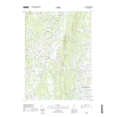
2018 Map of Avon
USGS Topo · Published 2018About this map
The Farmington River carves a central path through this Connecticut landscape, separating the residential expansions of Avon and Weatogue from the prominent heights of Metacomet Ridge. This modern survey reveals a dense network of suburban development intertwined with significant topographical barriers like Talcott Mtn and King Phillip Mtn. The river valley acts as a historical and geographical corridor, flanked by established settlements such as West Avon and Simsbury. Genealogists and local historians will find a high concentration of burial sites, including the Center Cem and Saint Ann Cem, which anchor the early community centers. Highlighting the intersection of natural conservation and modern living, the New England National Scenic Trail winds along the eastern ridgelines, overlooking water features like Hartford Reservoir Number 2 and the winding Nod Brook.
Find a feature on this map
286 named features on this map. Tap any name to fly to it.
Don’t see what you’re looking for? This feature index may not catch every label — zoom into the map to look around manually.
Map Details
Editions of this 2018 Avon Map
This is the sole edition of this map. No revisions or reprints were ever made.
Other maps of this area

1892 · Hartford
USGS Topo · 1:62,500

1892 · Meriden
USGS Topo · 1:62,500

1892 · Granby
USGS Topo · 1:62,500

1893 · Middletown
USGS Topo · 1:62,500

1893 · Meriden
USGS Topo · 1:62,500

1906 · Farmington
USGS Topo · 1:125,000

1928 · Windsor Locks
USGS Topo · 1:24,000

1928 · Windsor
USGS Topo · 1:24,000

1944 · Hartford South
USGS Topo · 1:31,680

1945 · Hartford North
USGS Topo · 1:31,680