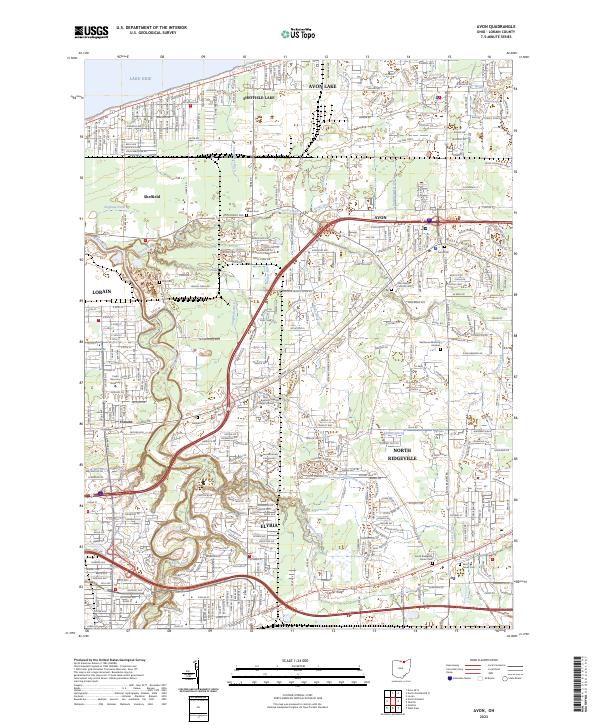
2023 Map of Avon
USGS Topo · Published 2023About this map
Lake Erie defines the northern boundary of this Lorain County landscape, where the modern suburban expansion of Avon Lake and Sheffield Lake meets an intricate network of historical drainage. A high density of local cemeteries, including the Saint Peters Cem, Avon Cem, and Saint Marys Catholic Cem, provides essential points of reference for genealogists tracking family plots in this long-settled region. The interior terrain is shaped by numerous named waterways such as French Creek, Klingshirn Ditch, and Jungbluth Ditch, reflecting the historical engineering required to manage the area's hydrology for both agricultural and residential use. Educational institutions like Lorain County Community College and Ohio Business College Lorain anchor the southwestern section near Elyria, while the thoroughfares of Detroit Rd and Center Ridge Rd continue to serve as the primary east-west arteries connecting these growing communities.
Find a feature on this map
48 named features on this map. Tap any name to fly to it.
Don’t see what you’re looking for? This feature index may not catch every label — zoom into the map to look around manually.
Map Details
Editions of this 2023 Avon Map
This is the sole edition of this map. No revisions or reprints were ever made.
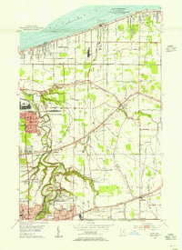
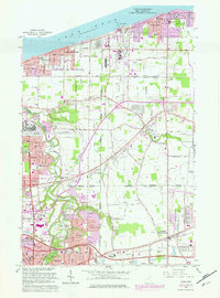
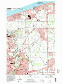
Historical Maps of Vincent Through Time
4 maps found