
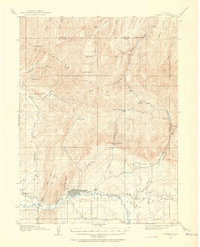
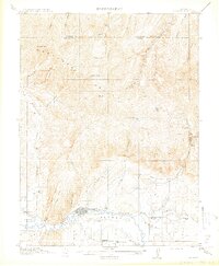
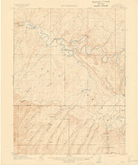
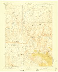
1912 Map of Axial
USGS Topo · Published 1958About this map
Juniper Hot Springs serves as a northern anchor for this 1912 landscape, where the Yampa River carves a deep winding path through the high country of Moffat County. The map details a ranching economy established along the water and mountain flanks, documented by family-named holdings such as K Diamond Ranch, Duffy Ranch, and Maudlin Ranch. A tunnel and the Government Bridge indicate early engineering efforts to manage the river's transit-defying geography.
Find a feature on this map
40 named features on this map. Tap any name to fly to it.
Don’t see what you’re looking for? This feature index may not catch every label — zoom into the map to look around manually.
Map Details
Editions of this 1912 Axial Map
This is the sole edition of this map. No revisions or reprints were ever made.
Other maps of this area

1907 · White River
USGS Topo · 1:125,000

1910 · Danforth Hills
USGS Topo · 1:125,000

1910 · White River
USGS Topo · 1:125,000
1912 · Meeker
USGS Topo · 1:62,500
1914 · Meeker
USGS Topo · 1:62,500
1914 · Axial
USGS Topo · 1:62,500
1915 · Monument Butte
USGS Topo · 1:62,500

1916 · Craig
USGS Topo · 1:125,000

1954 · Vernal
USGS Topo · 1:250,000

1954 · Craig
USGS Topo · 1:250,000