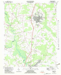
1982 Map of Ayden
USGS Topo · Published 1983About this map
The Seaboard Coast Line corridor anchors the eastern coastal plain in this 1982 survey, connecting the towns of Ayden, Hanrahan, and Grifton. The landscape is defined by the winding course of Contentnea Creek and its associated wetlands, which separate Pitt, Greene, and Lenoir counties. While the town centers show established grids, the surrounding countryside is dotted with small rural landmarks including Pleasant Plains Ch, Zion Chapel, and Little Cr Ch, reflecting the area's agricultural and spiritual foundations.
Find a feature on this map
33 named features on this map. Tap any name to fly to it.
Don’t see what you’re looking for? This feature index may not catch every label — zoom into the map to look around manually.
Map Details
Editions of this 1982 Ayden Map
This is the sole edition of this map. No revisions or reprints were ever made.
Other maps of this area

1902 · Ayden
USGS Topo · 1:62,500

1903 · Winterville
USGS Topo · 1:62,500

1904 · Ayden
USGS Topo · 1:62,500

1904 · Falkland
USGS Topo · 1:62,500

1905 · Winterville
USGS Topo · 1:62,500

1914 · Kinston
USGS Topo · 1:48,000

1916 · Kinston
USGS Topo · 1:62,500

1953 · Rocky Mount
USGS Topo · 1:250,000

1954 · Rocky Mount
USGS Topo · 1:250,000
1981 · Farmville
USGS Topo · 1:24,000