
Historical Maps of Pitt County, North Carolina
What stories do these 71 old maps tell about Pitt County's past? From 1901 to present day, these maps reveal the evolution of streets, neighborhoods, iconic landmarks, and natural features in stunning high-res detail. Whether you're a history enthusiast, genealogist, or professional in education, environmental work, or architecture, these maps are perfect for exploration, research, and discovery.
Discover Pitt County's history through maps:
- Trace Pitt County's growth: Explore earlier and latest maps and editions to uncover how the region changed over time.
- Examine technical details: Each map includes its creators, publishers, scale, dimensions, and full source information.
- Layer maps with modern tools & imagery: Compare historical maps to modern-day with high-resolution satellite imagery and detailed LiDAR layers.
- Sourced from trusted archives: Carefully preserved and digitized by institutions like the United Stated Geological Survey and the US Library of Congress.
- Access in any format: View and explore in high resolution, download for offline use, or order a museum-quality print for yourself or a loved one.
Begin your journey into Pitt County's history with these remarkable must-see maps.
Pitt County, NC maps
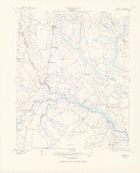
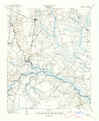
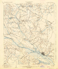
(71)- 1901 Map of Parmele, 1971 Print
 1901 Parmele1971 Print · USGSCovers Pitt County, including Bethel, Robersonville, and other nearby areas
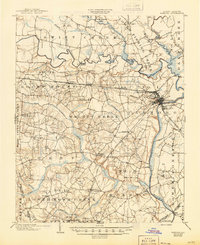
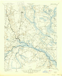
 - 1901 Map of Williamston, 1972 Print
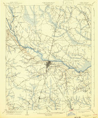
 1901 Williamston1972 Print · USGSCovers Pitt County, including Williamston, Robersonville, and other nearby areas
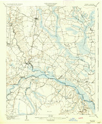
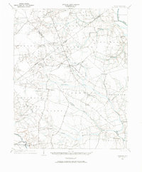
 - 1902 Map of Williamston, 1944 Print
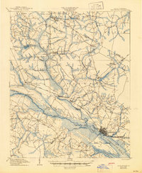
 1902 Williamston1944 Print · USGSCovers Pitt County, including Williamston, Robersonville, and other nearby areas
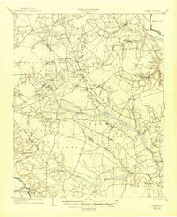
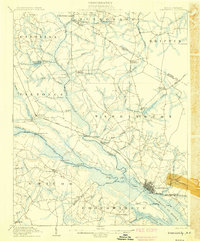
 - 1902 Map of Parmele, 1959 Print
 1902 Parmele1959 Print · USGSCovers Pitt County, including Bethel, Robersonville, and other nearby areas
 - 1902 Map of Ayden, 1962 Print
 1902 Ayden1962 Print · USGSCovers Pitt County, including Kinston, Ayden, and other nearby areas
 - 1902 Map of Ayden, 1962 Print
 1902 Ayden1962 Print · USGSCovers Pitt County, including Kinston, Ayden, and other nearby areas
 - 1902 Map of Vanceboro, 1968 Print
 1902 Vanceboro1968 Print · USGSCovers Pitt County, including Vanceboro, Elmira Crossroads, and other nearby areas
 - 1902 Map of Tarboro, 1968 Print
 1902 Tarboro1968 Print · USGSCovers Pitt County, including Rocky Mount, Tarboro, and other nearby areas
 - 1903 Map of Tarboro, 1935 Print
 1903 Tarboro1935 Print · USGSCovers Pitt County, including Rocky Mount, Tarboro, and other nearby areas
 - 1903 Map of Tarboro, 1945 Print
 1903 Tarboro1945 Print · USGSCovers Pitt County, including Rocky Mount, Tarboro, and other nearby areas
 - 1903 Map of Winterville, 1954 Print
 1903 Winterville1954 Print · USGSCovers Pitt County, including Greenville, Winterville, and other nearby areas
 - 1903 Map of Chocowinity, 1968 Print
 1903 Chocowinity1968 Print · USGSCovers Pitt County, including Washington, Chocowinity, and other nearby areas
 - 1904 Map of Ayden
 1904 Ayden1904 Print · USGSCovers Pitt County, including Kinston, Ayden, and other nearby areas
 - 1904 Map of Ayden, 1936 Print
 1904 Ayden1936 Print · USGSCovers Pitt County, including Kinston, Ayden, and other nearby areas
 - 1904 Map of Falkland, 1936 Print
 1904 Falkland1936 Print · USGSCovers Pitt County, including Farmville, Fountain, and other nearby areas
 - 1904 Map of Vanceboro, 1936 Print
 1904 Vanceboro1936 Print · USGSCovers Pitt County, including Vanceboro, Elmira Crossroads, and other nearby areas
 - 1904 Map of Falkland, 1945 Print
 1904 Falkland1945 Print · USGSCovers Pitt County, including Farmville, Fountain, and other nearby areas
 - 1904 Map of Ayden, 1945 Print
 1904 Ayden1945 Print · USGSCovers Pitt County, including Kinston, Ayden, and other nearby areas
 - 1904 Map of Ayden, 1945 Print
 1904 Ayden1945 Print · USGSCovers Pitt County, including Kinston, Ayden, and other nearby areas
 - 1904 Map of Falkland, 1973 Print
 1904 Falkland1973 Print · USGSCovers Pitt County, including Farmville, Fountain, and other nearby areas
 - 1905 Map of Chocowinity
 1905 Chocowinity1905 Print · USGSCovers Pitt County, including Washington, Chocowinity, and other nearby areas
 - 1905 Map of Chocowinity, 1936 Print
 1905 Chocowinity1936 Print · USGSCovers Pitt County, including Washington, Chocowinity, and other nearby areas
 - 1905 Map of Winterville, 1942 Print
 1905 Winterville1942 Print · USGSCovers Pitt County, including Greenville, Winterville, and other nearby areas
 - 1905 Map of Chocowinity, 1945 Print
 1905 Chocowinity1945 Print · USGSCovers Pitt County, including Washington, Chocowinity, and other nearby areas
 - 1905 Map of Vanceboro, 1945 Print
 1905 Vanceboro1945 Print · USGSCovers Pitt County, including Vanceboro, Elmira Crossroads, and other nearby areas
Showing maps 1-25 of 71
Top cities in Pitt County
- Greenville historical maps
- Ayden historical maps
- Winterville historical maps
- Farmville historical maps
- Bethel historical maps
- Fountain historical maps
See more
Frequently asked questions
- What are the different types of historical maps available for Pitt County?
- What is the oldest map of Pitt County?
- Where can I purchase historical maps of Pitt County for my home or office?
- Where can I download high-res historical maps of Pitt County?
- Are there historical topographic maps available for Pitt County?
- Is there historical aerial imagery available for Pitt County?
- Where are historical maps of Pitt County sourced from?