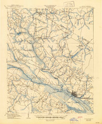
1905 Map of Chocowinity
USGS Topo · Published 1945About this map
Washington serves as the focal point of this coastal plain survey, situated at the widening junction where the Tar River becomes the Pamlico River. The early 20th-century landscape is defined by its reliance on water-based commerce and travel, evidenced by numerous river landings such as Yankee Hall Ldg., Boyd Ferry Ldg., and Grimes Ldg.. A notable Steamboat Route tracks through the river channel, linking these small riverside outposts to the larger port. Inland, the topography is dominated by extensive drainage systems like Bear Swamp and Gum Swamp, which supported local industries at Shepherd Millpond and Harris Millpond. Agriculture and small-town growth are visible along the Atlantic Coast Line R. R. and at established junctions like Pactolus, Woolard Crossroads, and Chocowinity. The map also captures the local vernacular of the period with specific landmarks like The Castle near the Washington waterfront.
Find a feature on this map
74 named features on this map. Tap any name to fly to it.
Don’t see what you’re looking for? This feature index may not catch every label — zoom into the map to look around manually.
Map Details
Editions of this 1905 Chocowinity Map
3 editions found

Other maps of this area

1901 · Parmele
USGS Topo · 1:62,500

1901 · Williamston
USGS Topo · 1:62,500

1902 · Williamston
USGS Topo · 1:62,500

1902 · Parmele
USGS Topo · 1:62,500

1902 · Ayden
USGS Topo · 1:62,500

1902 · Vanceboro
USGS Topo · 1:62,500

1903 · Winterville
USGS Topo · 1:62,500

1903 · Chocowinity
USGS Topo · 1:62,500

1904 · Ayden
USGS Topo · 1:62,500

1904 · Vanceboro
USGS Topo · 1:62,500