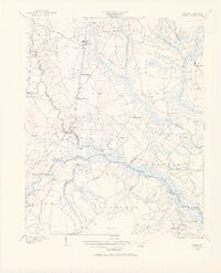
1902 Map of Ayden
USGS Topo · Published 1962About this map
Neuse River and Contentnea Creek dominate this coastal plain landscape at the turn of the century, serving as vital transit corridors evidenced by the dense concentration of landings. From Bectons Old Field Landing down to Pitchkettle Ldg., these river access points reveal a water-based economy that persisted even as the Atlantic Coast Line railroad began transforming inland towns like Ayden and Grifton. The map captures a transition in regional transport, where traditional Steamboat Routes operated alongside timber-oriented Tramroads stretching into the surrounding swamps.
Find a feature on this map
65 named features on this map. Tap any name to fly to it.
Don’t see what you’re looking for? This feature index may not catch every label — zoom into the map to look around manually.
Map Details
Editions of this 1902 Ayden Map
2 editions found
Other maps of this area

1901 · New Bern
USGS Topo · 1:62,500

1902 · Ayden
USGS Topo · 1:62,500

1902 · Vanceboro
USGS Topo · 1:62,500

1903 · New Bern
USGS Topo · 1:62,500

1903 · Winterville
USGS Topo · 1:62,500

1903 · Trent River
USGS Topo · 1:62,500

1903 · Chocowinity
USGS Topo · 1:62,500

1904 · Ayden
USGS Topo · 1:62,500

1904 · Trent River
USGS Topo · 1:62,500

1904 · Falkland
USGS Topo · 1:62,500