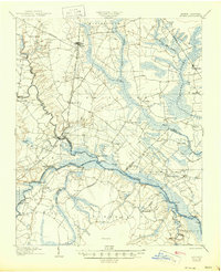
1904 Map of Ayden
USGS Topo · Published 1945About this map
Fort Barnwell and Ayden anchor this 1902 survey of the Eastern North Carolina coastal plain, a landscape defined by the convergence of the Neuse River, Contentnea Creek, and Swift Creek. The map documents a river-dependent economy transitioning toward rail, with a dense network of river landings such as Bectons Old Field Landing, Village Ldg., and Pitchkettle Ldg. serving the many "necks" of land formed by the winding waterways. The Atlantic Coast Line and Norfolk & Southern RR cut through the interior, connecting smaller settlements like Hanrahan, Littlefield, and Grifton. Between the river bottoms and the upland Sand Hill region, the map reveals the complex drainage of the Indian Well Swamp and Eagle Swamp, alongside established industrial sites like Johnsons Mills. These details provide a clear look at early twentieth-century transport, where tram roads and steamboat routes still moved goods through the Pocoson wetlands.
Find a feature on this map
66 named features on this map. Tap any name to fly to it.
Don’t see what you’re looking for? This feature index may not catch every label — zoom into the map to look around manually.
Map Details
Editions of this 1904 Ayden Map
4 editions found
Other maps of this area

1901 · New Bern
USGS Topo · 1:62,500

1902 · Ayden
USGS Topo · 1:62,500

1902 · Vanceboro
USGS Topo · 1:62,500

1903 · New Bern
USGS Topo · 1:62,500

1903 · Winterville
USGS Topo · 1:62,500

1903 · Trent River
USGS Topo · 1:62,500

1903 · Chocowinity
USGS Topo · 1:62,500

1904 · Ayden
USGS Topo · 1:62,500

1904 · Trent River
USGS Topo · 1:62,500

1904 · Falkland
USGS Topo · 1:62,500