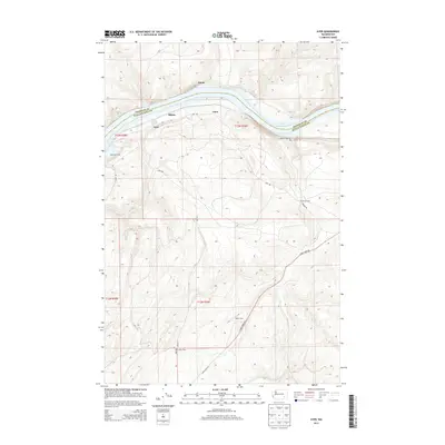
2013 Map of Ayer
USGS Topo · Published 2013About this map
Ayer Junction serves as a focal point for the transport landscape along the Snake River corridor at the boundary of Franklin and Walla Walla counties. The waterway is dominated by Lake Herbert G-W, which dictates the surrounding topography and access points such as the Ayer Boat Basin. Small railroad-linked settlements and sidings like Ayer, Rifton, Chew, and Davin line the river banks, reflecting a landscape defined by the movement of goods and agricultural production.
Find a feature on this map
20 named features on this map. Tap any name to fly to it.
Don’t see what you’re looking for? This feature index may not catch every label — zoom into the map to look around manually.
Map Details
Editions of this 2013 Ayer Map
This is the sole edition of this map. No revisions or reprints were ever made.
Other maps of this area

1919 · Walla Walla
USGS Topo · 1:125,000

1921 · Walla Walla
USGS Topo · 1:125,000

1948 · Starbuck
USGS Topo · 1:62,500

1948 · Ayer
USGS Topo · 1:62,500

1950 · Starbuck
USGS Topo · 1:62,500

1950 · Haas
USGS Topo · 1:62,500

1953 · Walla Walla
USGS Topo · 1:250,000

1958 · Walla Walla
USGS Topo · 1:250,000

1967 · Waitsburg NW
USGS Topo · 1:24,000
1967 · Clyde
USGS Topo · 1:24,000