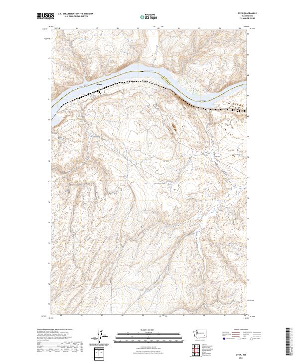
2023 Map of Ayer
USGS Topo · Published 2023About this map
The Snake River carves a deep, winding path through this portion of the Pacific Northwest, serving as the primary geographic corridor between Franklin and Walla Walla counties. The small settlement of Ayer sits along the southern bank, positioned near the junction of several rural routes including Ayer Rd and Casey Rd. Nearby, the locales of Rifton and Chew trace the river’s edge, illustrating the historic reliance on the waterway for regional connectivity and transport. The terrain south of the river rises sharply into a series of ridges and draws, most notably around Fields Gulch. This modern survey documents the contemporary rural landscape, where established roads like Lyons Ferry Rd provide access through the complex topography of the river breaks and surrounding upland plateaus.
Find a feature on this map
14 named features on this map. Tap any name to fly to it.
Don’t see what you’re looking for? This feature index may not catch every label — zoom into the map to look around manually.
Map Details
Editions of this 2023 Ayer Map
This is the sole edition of this map. No revisions or reprints were ever made.
Other maps of this area

1919 · Walla Walla
USGS Topo · 1:125,000

1921 · Walla Walla
USGS Topo · 1:125,000

1948 · Starbuck
USGS Topo · 1:62,500

1948 · Ayer
USGS Topo · 1:62,500

1950 · Starbuck
USGS Topo · 1:62,500

1950 · Haas
USGS Topo · 1:62,500

1953 · Walla Walla
USGS Topo · 1:250,000

1958 · Walla Walla
USGS Topo · 1:250,000

1967 · Waitsburg NW
USGS Topo · 1:24,000
1967 · Clyde
USGS Topo · 1:24,000