
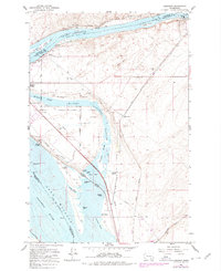
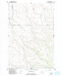
1981 Map of Ayer
USGS Topo · Published 1981This historical map portrays the area of Ayer in 1981, primarily covering Walla Walla County as well as portions of Franklin County. Featuring a scale of 1:24000, this map provides a highly detailed snapshot of the terrain, roads, buildings, counties, and historical landmarks in the Ayer region at the time. Published in 1981, it is the sole known edition of this map.
Find a feature on this map
23 named features on this map. Tap any name to fly to it.
Don’t see what you’re looking for? This feature index may not catch every label — zoom into the map to look around manually.
Map Details
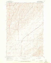
Editions of this 1981 Ayer Map
This is the sole edition of this map. No revisions or reprints were ever made.
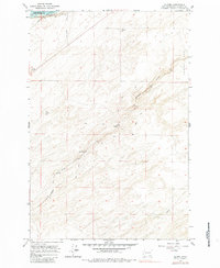
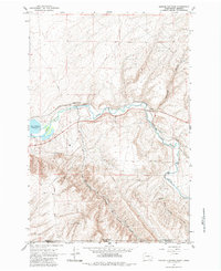
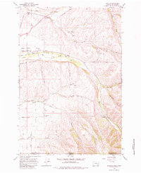
Historical Maps of Davin Through Time
31 maps found

1915 Wallulah
Walla Walla County, WA
1964 Humorist
Walla Walla County, WA
1964 Slater
Walla Walla County, WA
1964 Zangar Junction
Walla Walla County, WA
1966 Buroker
Walla Walla County, WA
1966 Coppei
Walla Walla County, WA

1966 Elwood
Walla Walla County, WA

1966 Eureka
Walla Walla County, WA

1966 Hadley
Walla Walla County, WA

1966 Kooskooskie
Walla Walla County, WA

1966 Lowden
Walla Walla County, WA

1966 Page
Walla Walla County, WA

1966 Rulo
Walla Walla County, WA

1966 Valley Grove
Walla Walla County, WA

1966 Welland
Walla Walla County, WA
1967 Clyde
Walla Walla County, WA
1967 Harsha
Walla Walla County, WA
1967 Pleasant View
Walla Walla County, WA
1981 Ayer
Walla Walla County, WA

1981 Monumental Rock
Walla Walla County, WA

1991 Elwood
Walla Walla County, WA

1991 Eureka
Walla Walla County, WA

1991 Hadley
Walla Walla County, WA

1991 Lowden
Walla Walla County, WA

1991 Page
Walla Walla County, WA

1991 Rulo
Walla Walla County, WA

1991 Slater
Walla Walla County, WA

1991 Zangar Junction
Walla Walla County, WA

1992 Humorist
Walla Walla County, WA

1992 Welland
Walla Walla County, WA

1995 Kooskooskie
Walla Walla County, WA