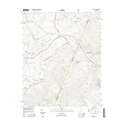
2014 Map of Ayersville
USGS Topo · Published 2014About this map
Currahee Mtn anchors the southeastern corner of this map, a prominent landmark in the vicinity of Toccoa. The landscape is a mix of protected woodland within the Chattahoochee National Forest and small upland communities such as Ayersville, New Switzerland, and Mount Airy. This 2014 survey records a high density of rural burial grounds, including the Chopped Oak Cem, Antioch Cem, and Laudermilk Cem, providing essential locations for genealogical research in this part of Georgia.
Find a feature on this map
108 named features on this map. Tap any name to fly to it.
Don’t see what you’re looking for? This feature index may not catch every label — zoom into the map to look around manually.
Map Details
Editions of this 2014 Ayersville Map
This is the sole edition of this map. No revisions or reprints were ever made.
Other maps of this area

1886 · Dahlonega
USGS Topo · 1:125,000

1886 · Walhalla
USGS Topo · 1:125,000

1891 · Gainesville
USGS Topo · 1:125,000

1891 · Carnesville
USGS Topo · 1:125,000

1892 · Dahlonega
USGS Topo · 1:125,000

1892 · Walhalla
USGS Topo · 1:125,000

1896 · Walhalla
USGS Topo · 1:125,000

1896 · Dahlonega
USGS Topo · 1:125,000

1903 · Dahlonega
USGS Topo · 1:125,000

1953 · Tallulah Falls
USGS Topo · 1:24,000