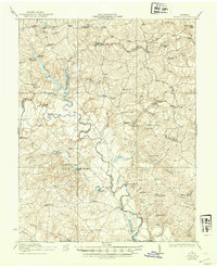
1933 Map of Aylett
USGS Topo · Published 1942About this map
The Mattaponi River serves as the central artery for this part of Tidewater Virginia, snaking between the borders of King and Queen, Caroline, and King William counties. The 1917 survey data reveals a landscape defined by small agrarian communities and water-powered industry, with many family-named mills situated along the tributaries, such as Broaddus Mill and Mitchell Mill. These sites, along with landings like Jones Landing and Pointers Landing, point to an economy deeply tied to the river's path and local timber or grain processing.
Find a feature on this map
87 named features on this map. Tap any name to fly to it.
Don’t see what you’re looking for? This feature index may not catch every label — zoom into the map to look around manually.
Map Details
Editions of this 1933 Aylett Map
2 editions found

Other maps of this area

1889 · Fredericksburg
USGS Topo · 1:125,000

1892 · Fredericksburg
USGS Topo · 1:125,000

1892 · Montross
USGS Topo · 1:62,500

1894 · Fredericksburg
USGS Topo · 1:125,000

1894 · Richmond
USGS Topo · 1:62,500

1895 · Richmond
USGS Topo · 1:62,500

1895 · Nomini
USGS Topo · 1:125,000

1895 · Montross
USGS Topo · 1:62,500

1898 · Nomini
USGS Topo · 1:125,000

1918 · Doswell
USGS Topo · 1:62,500