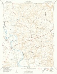
1949 Map of Aylett
USGS Topo · Published 1949About this map
The Mattaponi River serves as the central artery for this mid-century portrait of King and Queen and King William Counties, shaping a landscape defined by historic landings and tidal reaches. The small village of Aylett stands as a focal point near the river crossing, supported by local industry at Aylett Mill and the nearby Aylett Pond. Along the riverbanks, traditional river-access points such as Old Hall Landing, Jones Landing, and Pointers Landing mark a transition from water-based transport to the post-war road network.
Find a feature on this map
37 named features on this map. Tap any name to fly to it.
Don’t see what you’re looking for? This feature index may not catch every label — zoom into the map to look around manually.
Map Details
Editions of this 1949 Aylett Map
2 editions found
Other maps of this area
1918 · Tappahannock
USGS Topo · 1:62,500
1918 · Aylett
USGS Topo · 1:62,500
1919 · New Kent
USGS Topo · 1:62,500
1919 · Tappahannock
USGS Topo · 1:62,500
1920 · King William
USGS Topo · 1:62,500
1933 · Aylett
USGS Topo · 1:62,500

1943 · Richmond
USGS Topo · 1:250,000
1944 · Mount Landing
USGS Topo · 1:31,680
1944 · Howertons
USGS Topo · 1:24,000
1945 · Howertons
USGS Topo · 1:31,680