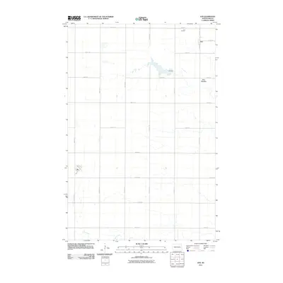
2011 Map of Ayr
USGS Topo · Published 2011About this map
The farming community of Erie and the rail-oriented site of Erie Junction anchor the northeastern landscape of this Cass County quadrangle. This 2011 survey captures the rural character of the Red River Valley, where a strict section-line road grid, including 20th St SE and 147th Ave SE, organizes the fertile agricultural territory. To the northwest of the main settlement lies the Erie Cemetery, a vital waypoint for genealogists tracing local families in the area. In the southwestern corner, the town of Ayr sits along the section lines, connected to the surrounding countryside by an extensive network of range and township roads. Water features are relatively sparse in this prairie environment, though Erie Dam and the meandering path of Swan Creek provide essential drainage and landmarks within the open terrain.
Find a feature on this map
24 named features on this map. Tap any name to fly to it.
Don’t see what you’re looking for? This feature index may not catch every label — zoom into the map to look around manually.
Map Details
Editions of this 2011 Ayr Map
This is the sole edition of this map. No revisions or reprints were ever made.
Other maps of this area

1895 · Casselton
USGS Topo · 1:125,000

1897 · Tower
USGS Topo · 1:125,000

1897 · Casselton
USGS Topo · 1:125,000

1952 · Grand Forks
USGS Topo · 1:250,000

1953 · Fargo
USGS Topo · 1:250,000

1956 · Fargo
USGS Topo · 1:250,000

1956 · Grand Forks
USGS Topo · 1:250,000

1966 · Grand Forks
USGS Topo · 1:250,000

1967 · Page SE
USGS Topo · 1:24,000

1967 · Ayr NE
USGS Topo · 1:24,000