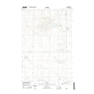
2014 Map of Ayr
USGS Topo · Published 2014About this map
Erie sits at the northeast corner of this Cass County landscape, a small community defined by its grid of streets including Main Ave and 20th St SE. The area's agricultural character is evidenced by the expansive section lines and rural infrastructure, such as the Schroeder Private Airport and the Erie Cem located just north of the town site. South of Erie Junction, the terrain is drained by the winding path of Swan Cr, which meanders through the southwestern portion of the quadrangle near the settlement of Ayr. This 2014 survey documents a classic North Dakota prairie landscape where small-scale aviation and family-named landmarks like Punton Private punctuate the vast stretches of farmland. The transportation network is built upon a rigid system of numbered avenues and streets, facilitating the movement of goods and people between these isolated rural hubs.
Find a feature on this map
25 named features on this map. Tap any name to fly to it.
Don’t see what you’re looking for? This feature index may not catch every label — zoom into the map to look around manually.
Map Details
Editions of this 2014 Ayr Map
This is the sole edition of this map. No revisions or reprints were ever made.
Other maps of this area

1895 · Casselton
USGS Topo · 1:125,000

1897 · Tower
USGS Topo · 1:125,000

1897 · Casselton
USGS Topo · 1:125,000

1952 · Grand Forks
USGS Topo · 1:250,000

1953 · Fargo
USGS Topo · 1:250,000

1956 · Fargo
USGS Topo · 1:250,000

1956 · Grand Forks
USGS Topo · 1:250,000

1966 · Grand Forks
USGS Topo · 1:250,000

1967 · Page SE
USGS Topo · 1:24,000

1967 · Ayr NE
USGS Topo · 1:24,000