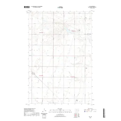
2020 Map of Ayr
USGS Topo · Published 2020About this map
Erie and Ayr anchor this section of Cass County, showing the grid-based settlement pattern of the North Dakota prairie. The landscape is defined by the rectilinear section-line road network, including Co Rd 3 and Co Rd 5, which organize the agricultural terrain. Significant local history is preserved at the Erie Cem north of town, while the southern reaches of the map are drained by the meandering course of Swan Cr. A notable characteristic of this modern survey is the concentration of small aviation sites, including Schroeder Private Airport, Pueppke Airport, and Punton Private Airport, which reflect the vast distances and logistical needs of high-plains farming. Between the primary settlements, Erie Junction marks a specific point of geographic interest along the road and former rail corridor near the county's eastern edge.
Find a feature on this map
31 named features on this map. Tap any name to fly to it.
Don’t see what you’re looking for? This feature index may not catch every label — zoom into the map to look around manually.
Map Details
Editions of this 2020 Ayr Map
This is the sole edition of this map. No revisions or reprints were ever made.
Other maps of this area

1895 · Casselton
USGS Topo · 1:125,000

1897 · Tower
USGS Topo · 1:125,000

1897 · Casselton
USGS Topo · 1:125,000

1952 · Grand Forks
USGS Topo · 1:250,000

1953 · Fargo
USGS Topo · 1:250,000

1956 · Fargo
USGS Topo · 1:250,000

1956 · Grand Forks
USGS Topo · 1:250,000

1966 · Grand Forks
USGS Topo · 1:250,000

1967 · Page SE
USGS Topo · 1:24,000

1967 · Ayr NE
USGS Topo · 1:24,000