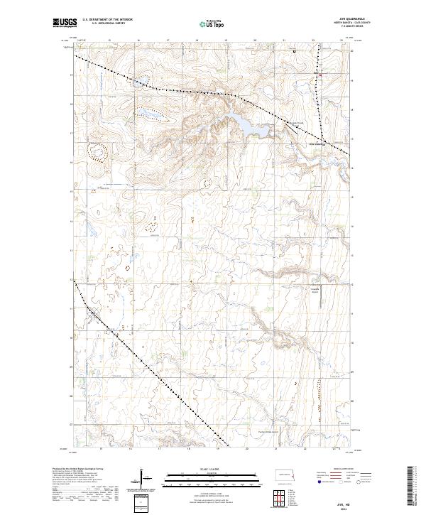
2024 Map of Ayr
USGS Topo · Published 2024About this map
Ayr and Erie are the primary hubs in this agricultural region of Cass County, North Dakota. The landscape is defined by the section-line road grid typical of the Great Plains, featuring a network of numbered streets and avenues such as 20th St SE and Co Rd 3. The small community of Erie Junction sits just south of Erie, while the Erie Cem serves as a local landmark for genealogical interest. Aviation is remarkably prominent in this rural setting, with three distinct facilities—Schroeder Private Airport, Pueppke Airport, and Punton Private Airport—spaced throughout the townships. Swan Creek provides the primary natural drainage, meandering through the prairie terrain. The map's detailed topography reveals the subtle elevation changes that characterize this portion of the Red River Valley upland.
Find a feature on this map
23 named features on this map. Tap any name to fly to it.
Don’t see what you’re looking for? This feature index may not catch every label — zoom into the map to look around manually.
Map Details
Editions of this 2024 Ayr Map
This is the sole edition of this map. No revisions or reprints were ever made.
Other maps of this area

1895 · Casselton
USGS Topo · 1:125,000

1897 · Tower
USGS Topo · 1:125,000

1897 · Casselton
USGS Topo · 1:125,000

1952 · Grand Forks
USGS Topo · 1:250,000

1953 · Fargo
USGS Topo · 1:250,000

1956 · Fargo
USGS Topo · 1:250,000

1956 · Grand Forks
USGS Topo · 1:250,000

1966 · Grand Forks
USGS Topo · 1:250,000

1967 · Page SE
USGS Topo · 1:24,000

1967 · Ayr NE
USGS Topo · 1:24,000