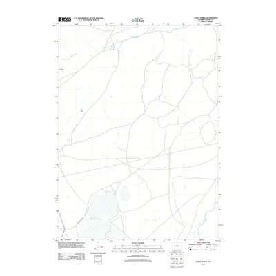
2012 Map of Ayres Spring
USGS Topo · Published 2012About this map
Dodge Ranch serves as a primary point of reference in this high-plains landscape of Albany County, where the topography is defined by the flow of the Laramie River and the northern reaches of Wheatland Reservoir Number 3. The terrain transitions from the water-rich bottomlands to prominent geological formations like Red Hill and Box Canyon. A network of intermittent drainages including Sevenmile Cr and Spring Cr provides a seasonal pulse to the region, connecting isolated water sources like Ayres Spring and Box Spring. Accessibility across this ranching country is maintained by the prominent Palmer Canyon Rd, which cuts through the southwestern section of the quadrangle. The map documents a sparsely populated but vital corridor of Wyoming’s interior, reflecting a persistent cattle-ranching heritage near the Laramie Range foothills.
Find a feature on this map
10 named features on this map. Tap any name to fly to it.
Don’t see what you’re looking for? This feature index may not catch every label — zoom into the map to look around manually.
Map Details
Editions of this 2012 Ayres Spring Map
This is the sole edition of this map. No revisions or reprints were ever made.
Other maps of this area

1954 · Torrington
USGS Topo · 1:250,000

1954 · Cheyenne
USGS Topo · 1:250,000

1955 · Mc Gill Lakes
USGS Topo · 1:24,000

1955 · Dodge Ranch
USGS Topo · 1:24,000

1955 · Bluegrass Wells
USGS Topo · 1:24,000

1955 · Sevenmile Spring
USGS Topo · 1:24,000

1955 · Ayres Spring
USGS Topo · 1:24,000

1955 · Cannonball Cut
USGS Topo · 1:24,000

1958 · Cheyenne
USGS Topo · 1:250,000

1958 · Torrington
USGS Topo · 1:250,000